Imlil to Ourika Valley: A 3-Day Hike in the High Atlas Mountains
This route in Morocco’s High Atlas Mountains takes hikers through a variety of landscapes, from lush forests and mountain passes to craggy peaks and breathtaking valleys.

It’s easy to be overwhelmed in Marrakech with its deluge of sights, sounds, and smells, especially in the bustling Jemaa el-Fnaa and the souks surrounding it. But it’s also easy to escape the frenzy of Marrakech and be in a completely different world — one where nature reigns and calm prevails. All you have to do is drive one hour south.
Two of the most popular nature retreats near Marrakech are Imlil Valley — where trekkers would begin their ascent of Mount Toubkal (4,167m), the highest peak in North Africa — and Ourika Valley, a lush and shady oasis dotted with waterfalls. The latter is on the foothills of the High Atlas Mountains while the former is tucked 1,800 metres high within it.
During my month-long trip to Morocco with my French friend Alex, we were keen to see both the areas surrounding Imlil Valley and Ourika Valley. But rather than making a two-hour loop by car between these two destinations, we decided to challenge ourselves to a route that is less commonly taken: a 40-kilometre hike through the Toubkal National Park from Imlil up to the mountain pass of Tizi n’Tacheddirt and down to the touristy village of Setti Fatma within the Ourika Valley.
This is how our three-day journey went.
Day 1: Imlil to Tacheddirt
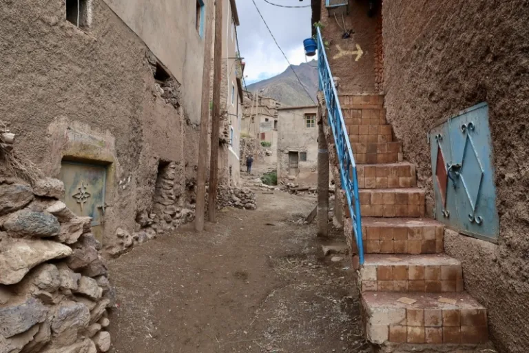
Before the start of our hike, we spent three nights in Imlil — or rather, a village called Ait Souka uphill from Imlil — to explore the area, recharge, and prepare ourselves for the road ahead. The guesthouse we stayed in, Dar Aymane, offered breathtaking views encompassing the floor of Imlil Valley to the snow-dusted peak of Mount Toubkal. The guesthouse owner, Hassan, provided valuable tips; in fact, we finalised the stops of our upcoming three-day hike with his precious help. He warned that the journey we were about to embark on will be tough, particularly for a non-avid hiker like myself.
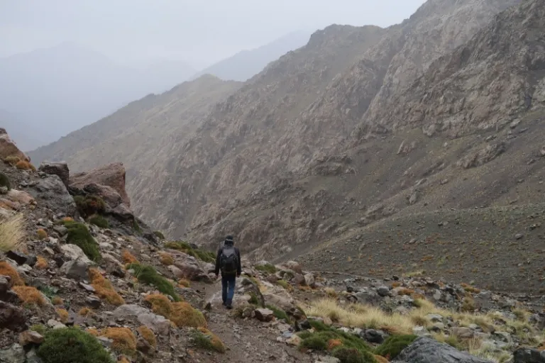
On our big day, we set off at 9am, geared with our backpacks, two bottles of water, and a packed sandwich prepared by Hassan. There was no gentle induction to the hike. We quickly overcame our morning inertia and warmed our lungs and legs as we followed a road sloping upwards. It led us to the village of Tamatert, onto a dirt path, across the river, and into a lush forest. Higher and higher we went, our slow walk punctuated by water breaks. Two hours later, when we reached the mountain pass of Tizi n’ Tamatert (2,358m), I let out a sigh of relief as the toughest part of the first day was finally over. The ascent of 500 metres was quite manageable, especially after all the self pep-talk and mental preparation I had over the past few days. A small cafe greeted us at the pass, and we could marvel at the views while savouring a cup of mint tea.
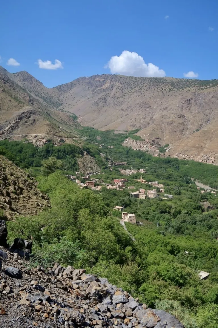
From there, we crunched on gravel as we went along one of the highest (and most dangerous) roads in Morocco. It was dotted with hairpin curves and at one point of the route even ran right through a scenic waterfall. To our left, the Imnane Valley was a stretch of luscious green at the base of barren, rocky mountains. Little villages were perched along the edges of the green oasis where it met the slopes uphill.
As we neared Tacheddirt, which is on the other side of the valley, we left the road to traverse the river via a bridge. Emptying into the river was a waterfall which we crossed by foot, our shoes in our hands. As we were nearing the village, we were witness to the daily lives of the locals; we saw an old lady casually leading a small flock of sheep along a dirt path and a group of men working tediously together by hand to reconstruct the road to the village. Once we reached the foot of the valley, we faced an uphill climb to Tacheddirt, where we were led by a kind gentleman to our room for the night in Gîte Likemte.
Day 2: Tacheddirt to Timchchi
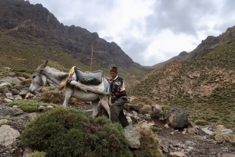
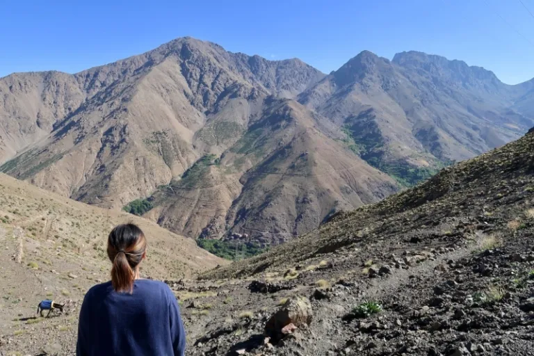
From the start, I knew that the second day was going to be the toughest part of the journey. From Tacheddirt, we had to ascend a whopping 900 metres to another mountain pass, Tizi n’Tacheddirt, which was the highest point of our hike at 3,230 metres above sea level. As I expected, the climb was gruelling. Along the way, on a rocky terrain full of shrubs, we met an old man who was holding on to the back of his donkey during his steady climb. We learned that he was blind from birth and he takes on the same hike each day, led by his healthy-looking donkey, carrying a box of Snickers and Mars and some cans of Coca-Cola to sell to the very occasional hikers at the peak. I could hardly believe it.
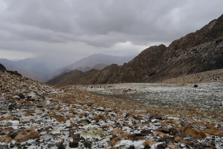
It took us four hours to reach the pass, and when we did, rain and ice fell from the sky. “We are in the shit”, exclaimed Alex with his funny French accent again and again, providing some comic relief in a dire situation. I must admit, I was worried as both options we had weren’t appealing: the lightning and slippery path if we continued, and the rapidly plummeting temperatures if we stayed. The blind man advised us to quickly make our descent but we decided it was safer to stay crouched under a rock with a plastic sheet as our rain cover until the worse of the hailstorm was over. I remember struggling to keep warm during the ordeal; even slipping on socks over my freezing hands took quite an effort. Thankfully, the storm cleared soon after and we could begin our descent.
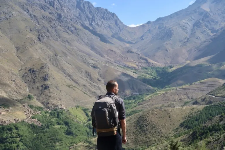
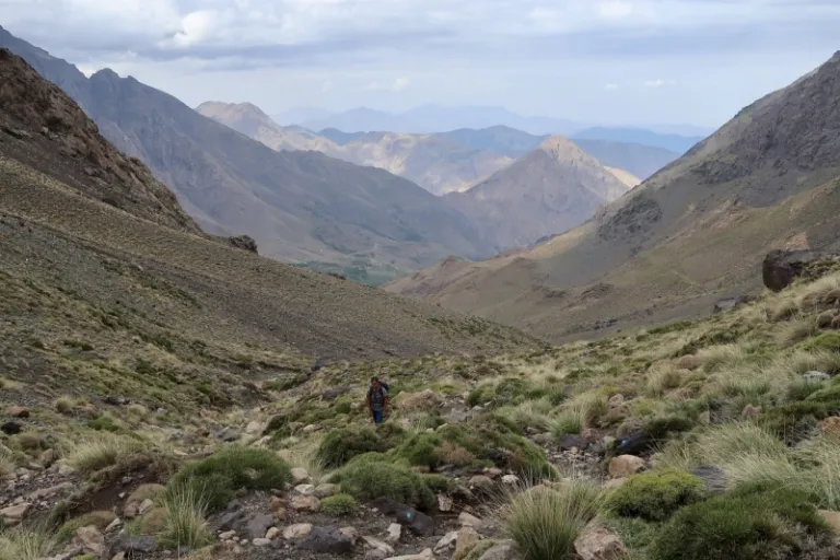
The scenery en route to Timchchi was some of the most dramatic I had seen in Morocco. The thin mist hanging in front of lofty mountains added to the ethereal atmosphere. We walked alongside untamed waterfalls and watched the landscape change the further down we went. We reached Labassene, a small village sitting atop terraced fields. Then we continued our way along a newly-built road that looked treacherous with huge rocks waiting to fall from the steep slopes.
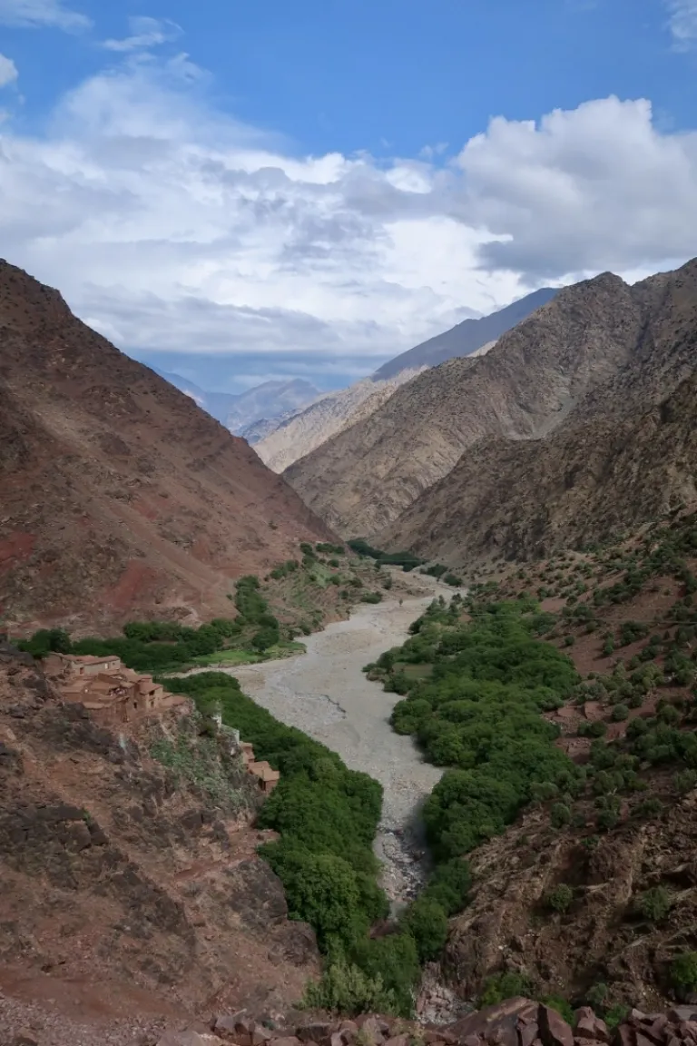
Some four hours later, or a total of eight hours since we left Tacheddirt, we arrived in Timchchi and caught our first sight of the famed Ourika Valley. It was a section that is less accessible. Hence, the place sees fewer visitors. And it was absolutely breathtaking. We bunked the night in the very affordable Gîte Ousalem, feeling weary but entirely satisfied by how we spent our day.
Day 3: Timchchi to Setti Fatma
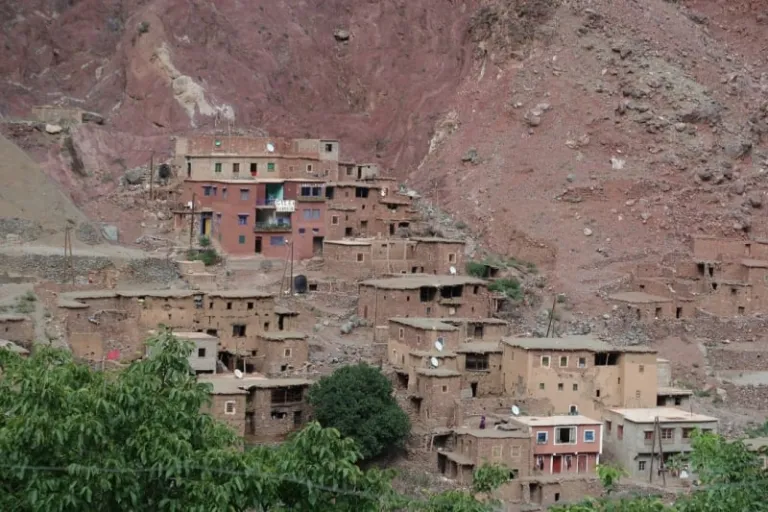
The final lap stretched 16 kilometres and was estimated to take just four hours. The guesthouse owner led us to the start of the track while explaining that the village of Timchchi is slowly moving to the other side of the valley where it is safer from the rivers of stones that could come crashing down from the mountains above in bad weather. In 1995, entire families were wiped out for this reason and their re-built homes stand eerily empty with nobody wanting to move in them.
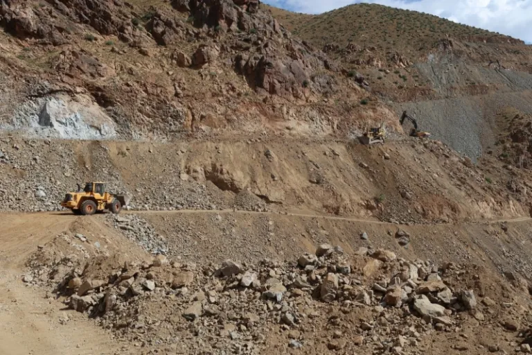
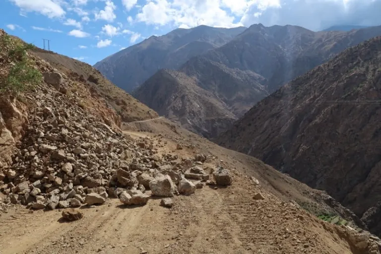
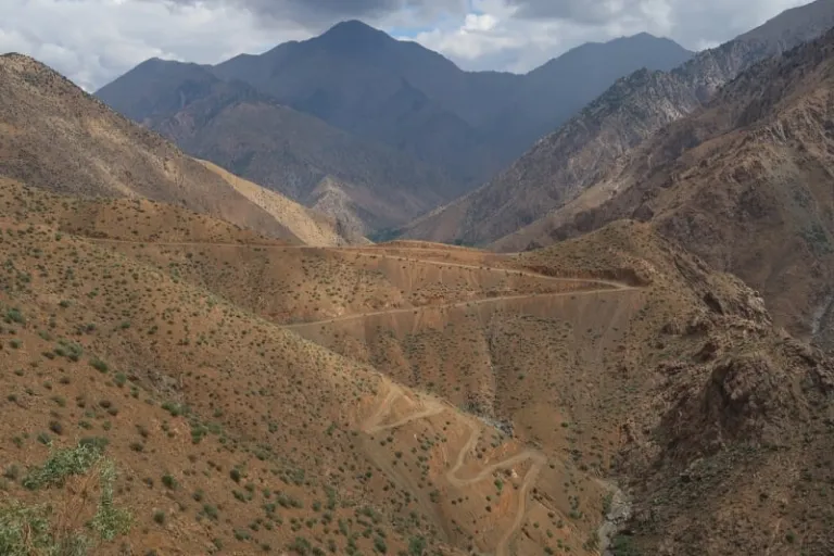
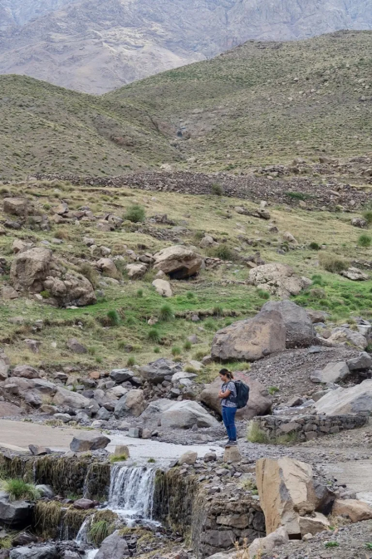
The first part of the walk was along a dirt path which eventually made way to a gravel road. There was a slightly steep ascent of 200 metres from the villages of Anfli to Tadrart, but it was nothing compared to the previous days. Before we knew it, we went from down in the valleys to high on perilous roads that criss-cross the craggy mountains. We met tractors that left piles of stones in our way as they were paving new roads and fixing old ones.
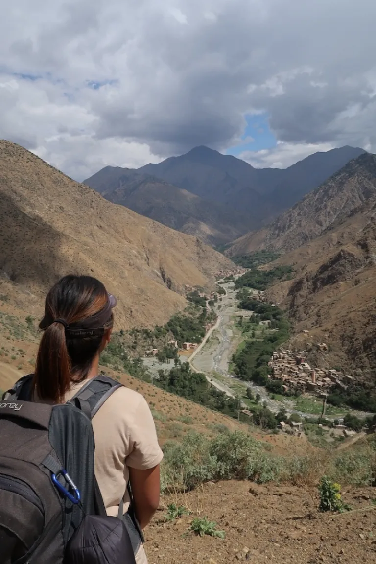
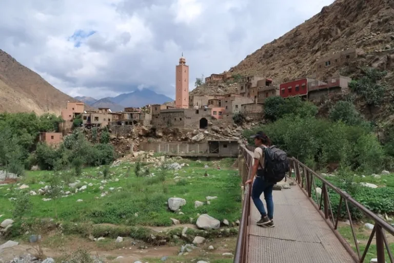
Walking on the road felt more monotonous and tiresome the closer we got to Setti Fatma. The end of the journey saw an unrelenting descent back down to the floor of the valley. I was quite eager to reach the final destination because from above, it looked unreservedly beautiful. The first village we came upon, Agadir-n-Ait Boulmane, was accessible from our side of the valley via a picturesque bridge. Two kilometres down was Setti Fatma, where all the tourists congregate. A string of restaurants lined the roadside in Setti Fatma and we picked one of the first ones we saw to indulge in a proper lunch.
We had finally completed our walk.
And my story is almost over, but not quite.
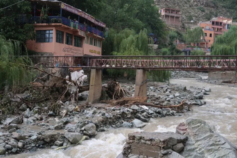
Mid-way through our lunch, it started to rain heavily. Soon after, sirens started to blare and a loud public announcement asked people to move away from the river and evacuate the valley. In five minutes, all the tourist cars left the parking lot, and camels and donkeys were led to higher grounds. We stayed only because the locals seemed unfazed (and I sensed that it was a frequent occurrence). Before this, we were told that flash floods had claimed many lives in this area. Once again, I was reminded of the dangers of living in such a wild environment. The mountains have never felt more alive and powerful than when I could see the sheer scale of it. Humans are but minuscule creatures that are vulnerable to the weather and the changes it brings to the landscape.
And with that, I could say that while the journey was physically challenging and undoubtedly breathtaking, it also humbled me, even if just for the moment.
Tips for future hikers
If you’re keen on walking from Imlil Valley to Ourika Valley as I did, here are some things to keep in mind:
- It’s important to understand the dangers of bad weather. On my trip, rain in the mountains was frequent in the afternoons, so we always set off early to beat it.
- There will be no phone reception and certainly no WiFi most of the journey. So do update your loved ones and tell them that you’ll be going off the grid before you set off.
- Download MAPS.ME as it will show you the roads and hiking trails available.
- Imlil and Ourika Valley are touristy and hence you’ll find some English speakers, but it’s always good to have handy a translation app (for French or Arabic) too.
- Bring along sufficient water and food for the journey, especially for the second day.
Enjoy the walk!
Also read: Ounila Valley Walk: Telouet to Ait Benhaddou in 5 Days
About Author

Dina is one who is constantly dreaming of elsewhere. Her favourite days are those spent traversing across the globe with a backpack, chasing every sunset. Find her on Instagram @dinamalyana.