Gunung Arong: Your Best Hiking Experience in Mersing, Johor
The trail is calling, and you must go.

Stunning islands, spectacular beaches, and good food are the first things that come to mind when we talk about Mersing — a coastal town in the northeastern state of Johor. The beautiful town is home to some of the best hidden gems in Malaysia. And this includes Gunung Arong, located west of Mersing town centre. Fellow hikers may or may not have heard about this great hiking spot, but one thing for sure is that it’s easily among the shortest and the safest in the country.
Where’s the fun in that, you ask? To quote Miley Cyrus, “It’s the climb” — and of course, what’s waiting for you at the peak! Read on for everything to expect when hiking Gunung Arong.
Also read: 8 Reasons Why Malaysia Is One of the Most Affordable Travel Destinations
Gunung Arong: What’s with the name?
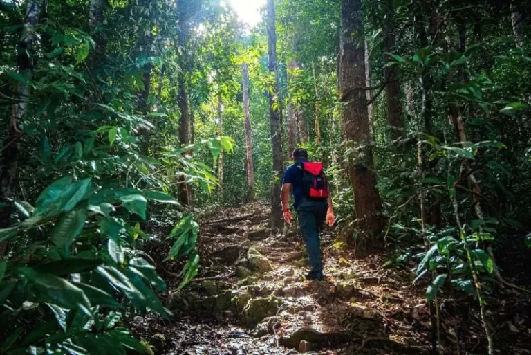
Image credit: Johor Forestry Official Website
If you’re wondering how the hill got its name, it all started with a man named Harun from Terengganu. The man is said to be the first person ever to climb the hill, and because his nickname is Arong, the peak is named after him. Gunung Arong literally translates to Mount Arong. Though it’s not technically a mountain, it’s still called as such since it’s the highest peak of Tanjung Resang, a beautiful cape in Mersing District.
All you need to know about hiking Gunung Arong
1. How to get there
Before we get into detail, it’s important to note that Gunung Arong is 240 metres high and nestles within a permanent forest reserve area known as Gunung Arong Recreational Forest. The Gunung Arong hiking difficulty level is between easy to slightly moderate. So, to all beginner hikers, it’s your time to shine!
Entrance 1
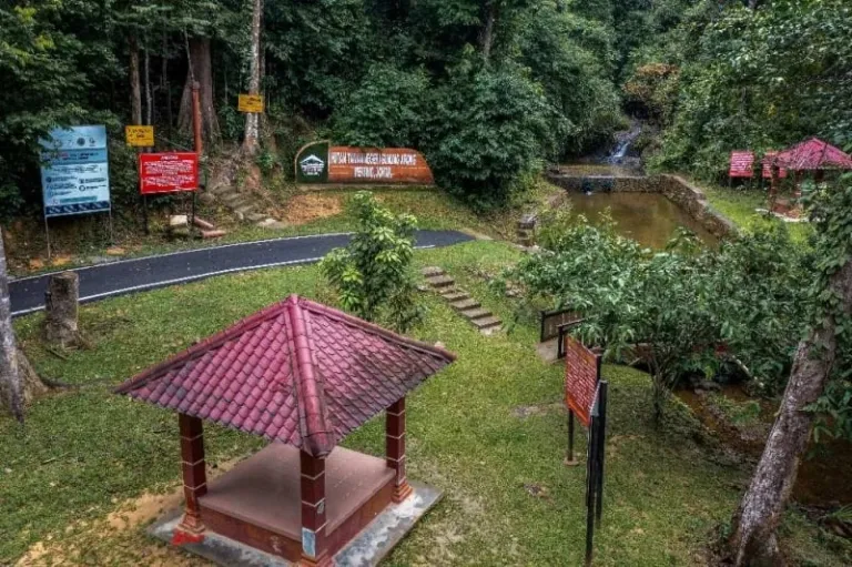
Image credit: Johor Forestry Official Website
This is the recommended route that we will explain in detail later. To use this trail, you will need to take the entrance within the recreational forest itself. If you’re coming from Mersing Jetty, reaching this area will take around a 17-minute drive (16km). For those coming from Endau, hop on a 19-minute drive (21km) before you reach the recreational forest. Once you’re there, the entrance is pretty obvious, as you can see from the picture above. Just climb the little stairs beside the red warning sign board, and you’ll be on the right track to the summit.
Duration: 30-45 minutes from the trailhead to the peak
Entrance 2
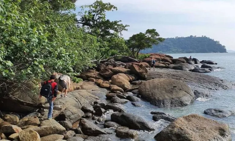
Image credit: syxplores
This alternative route is quite popular among the more experienced hikers. To use the second entrance, you’ll need to park your car at Teluk Gorek campsite (29 minutes drive from Endau and 27 minutes drive from Mersing Jetty). Then, traverse the beaches, mangrove trees, and rock terrains for about two kilometres before you get to the trailhead.
FYI, the second entrance is marked with double red lines on the stem of a tree by the shore. You’ll see a wooden swing nearby, hung on the branch of another tree in front of the marked tree.
Duration: 1.5-2 hours from the campsite to the peak
2. The best time to go hiking in Gunung Arong
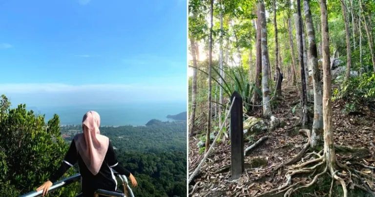
Image credit: Syafiqah Abu Talip
The recommended time to hike is between May and September, as Malaysia’s rainy season follows shortly after. Though we can never be sure of the forecast (along with the effects of climate change), the safest time would be during those months. However, if you’re already within the vicinity and/or accustomed to Malaysian weather, any sunny day without heavy downpour the night before will do.
Also, note that the weather in Malaysia can get to 32°C or sometimes even higher in the afternoon. So, it’s best to start your journey early in the morning or later in the evening to beat the heat.
To make things easy for first-timers, we recommend you take the first entrance (inside the recreational forest), and start hiking as early as 7.30am as the recreational forest only opens at 7am. Anytime later than that is also fine, as long as you time your return before 6pm. To those planning to take the second entrance (the beach route), it is best to start your journey only after the sun fully comes out. The coastal path can be dangerous in the dark.
3. Tips to know before your Gunung Arong hike
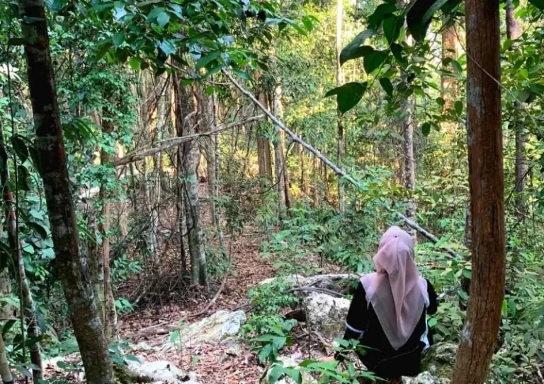
Image credit: Syafiqah Abu Talip
Permit
Yes. You will need a permit to hike Gunung Arong. But fret not because you can always get one from the East Johor District Forest Office (Pejabat Hutan Daerah Johor Timur) located along Jalan Ibrahim in Mersing town centre. The hiking fee is RM10 per head.
Operation hours: 8.00am to 4.00pm, Monday to Friday
Contact number: 07-798-1030
Things to bring
Aside from appropriate hiking clothes, you might want to bring a bottle of water, some light snacks, mosquito repellent, a first-aid kit and a hiking stick (especially for the elderly and first-time hikers). It’s also best to wear hiking shoes or boots during the day for safety reasons. Another thing that might come in handy is a waterproof jacket, in case it rains out of nowhere.
For those who wish to hike from the beach entrance, it is recommended that you wear a dri-fit shirt as your clothes might get wet before you reach the trailhead. And of course, bring your hat/cap, ladies and gentlemen; and most importantly, don’t forget your sunscreen!
4. During the hike
The trail from Entrance 1
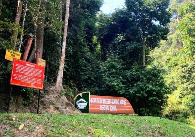
Image credit: Syafiqah Abu Talip
As mentioned previously, we will explain in detail the hiking trail from Entrance 1. First off, find the orange architectural signboard with the site name written on it. Between that signboard and the red warning sign, you’ll see a set of little stairs. That’ll be your entrance, from where you’ll kick off your Gunung Arong hiking adventure.
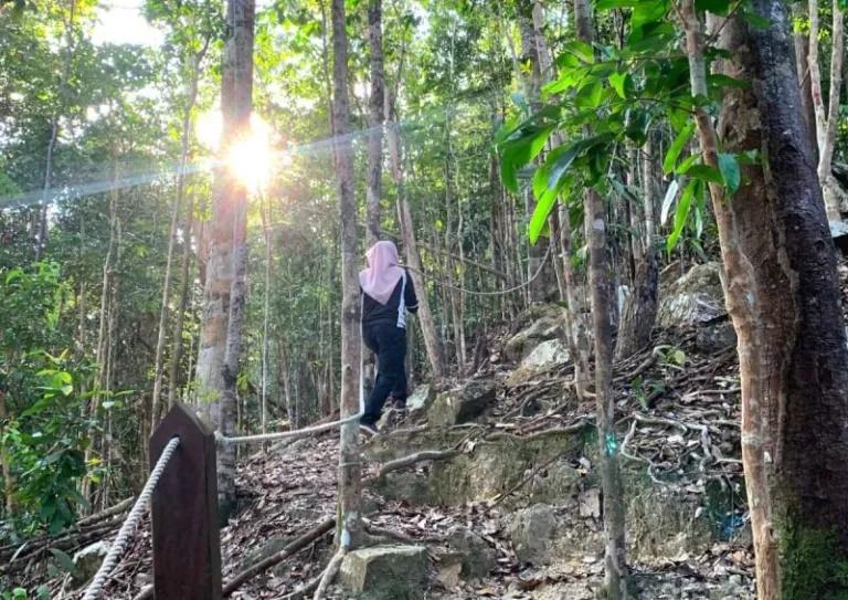
Image credit: Syafiqah Abu Talip
Though the initial trail is a bit steep, it’s pretty straightforward and there’s a long rope that will aid your journey further up the hill. The ground and roots have formed into the shape of stretched stairs that you can easily step on. However, be extra careful with the protruding roots as you might trip if you step on one.
You don’t have to worry about getting lost as the trail is relatively well-marked. All you need to do is to follow the red marks on the trees around you, and you’re good.
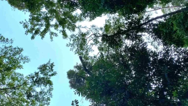
Image credit: Syafiqah Abu Talip
While hiking, you’ll notice that most parts of the path are covered by canopies of lush, giant trees. So, rest assured that it’s not too hot up there. Aside from taking Insta-worthy shots for the ’Gram, don’t forget to immerse yourself in the beauty of nature. Listen to the insects humming and the leaves crunching underneath your feet.
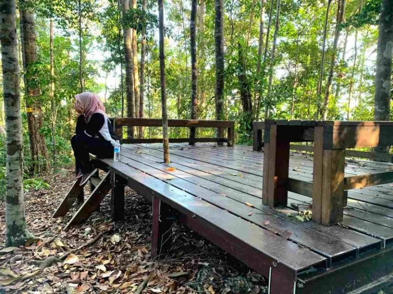
Image credit: Syafiqah Abu Talip
As you move further up the hill, this pangking (huge bench for resting) will be there waiting for you. Here, you can rest and take a breather before you resume the climb. And yes, you can also munch down some snacks if you want. (Psstt, the pangking can be good news to you because it indicates that the peak is just a few steps away!)
The trail from Entrance 2
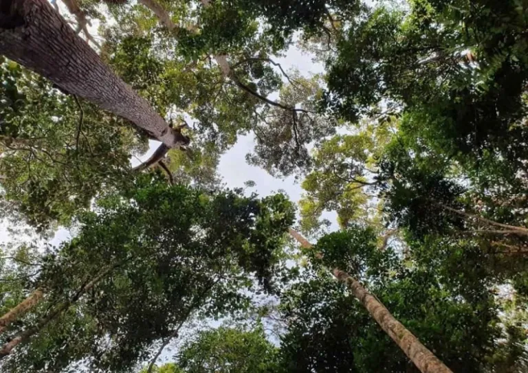
Image credit: syxplores
There’s not much difference between the trail from Entrance 1 and Entrance 2, except from the fact that they are opposite each other. The trail is wide and the initial path gently slopes as you hike further. You don’t even have to worry about having to scramble on all fours as the trail is not that steep.
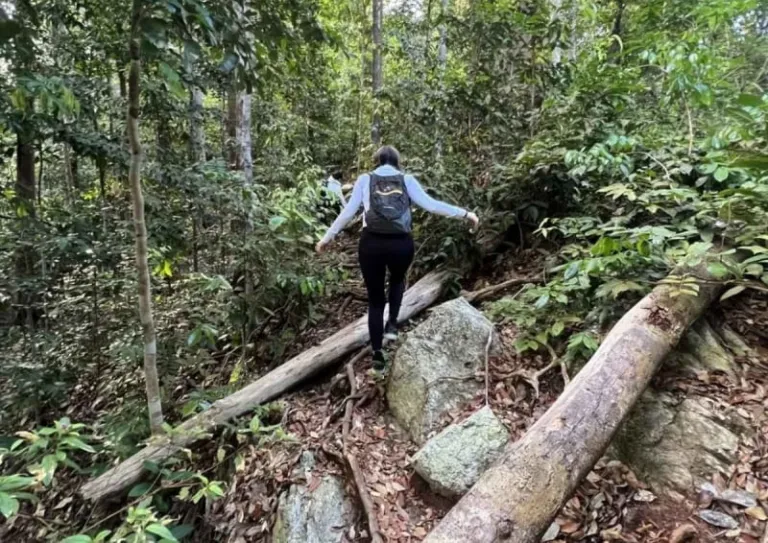
Image credit: suitlee218
Many who have taken this Gunung Arong trail have reported that there are a bunch of uprooted trees along the trail. Hikers would usually rest on the fallen trees before resuming their journey. Plus, a lot of huge rocks can be found along the trail. So, if you need to sit for a while, just pick the safest natural bench around you.
5. The summit of Gunung Arong
The summit from Entrance 1
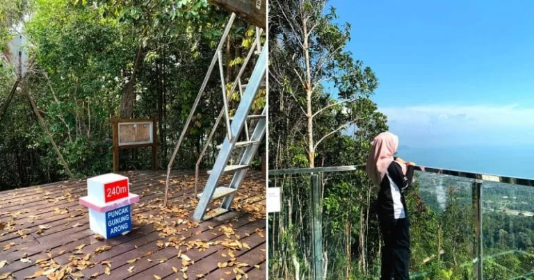
Image credit: Syafiqah Abu Talip
And you made it! Climb up the ladder and you’ll be standing on a viewing tower that overlooks Tanjung Resang and the vast South China Sea. On a clear day, you can even see Tioman Island from the peak. There’s also a glass platform that lets you savour the breathtaking vista of the bay and the neighbouring islands.
The summit from Entrance 2
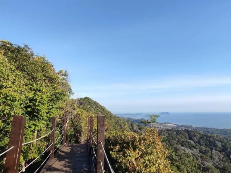
Image credit: Farhan Nasri
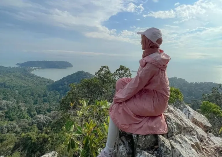
Image credit: Syahirah Stargazer
As you ascend higher and nearer to the peak, there’s a beautiful wooden bridge awaits you. From there, you can already enjoy the scenery of the sky and the sea behind you. There’s also the famous white rock where hikers would usually commemorate their climb by snapping photos of them sitting on top of it, looking out to the picturesque view that lies ahead of them. And you should do that too!
6. After the hike
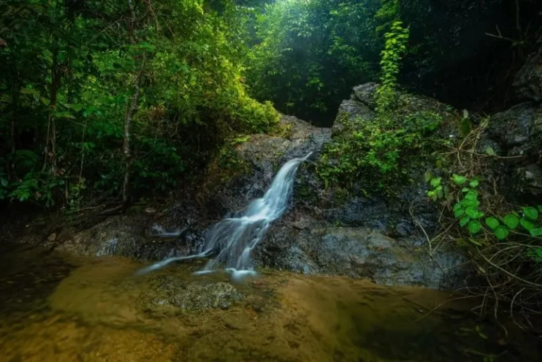
Image credit: Johor Forestry Official Website
Exit from Entrance 1: To keep the fun from ending at the summit, you can descend through the beach side of the trek (opposite the one you hiked) via a wooden bridge and dip in the cooling sea waters. Afterwards, trek back and down to your car park at the recreational forest. OR you can just descend the same route (u-turn) and relax at the waterfall near the first entrance you took.
Exit from Entrance 2: If you don’t wish to take the same route you hiked, you may ascend through the trail from Entrance 1. But, make sure there’s another car parked at the recreational forest. If not, you can always trek back from where you start and still enjoy the beachside view as you walk towards the car park of Teluk Gorek campsite.
Also read: 12+ Natural Attractions in Johor That Will Whisk You Away From City Life
And that concludes your Gunung Arong hiking in Mersing. Feeling excited yet? You’ll be more so when you experience the climb yourself!
Featured image credit: Johor Forestry | Official Website
About Author

Izzati is an author to two poem anthologies, a slam poet wannabe, and a full-time nanny to her kitties. She loves dreaming about traveling the world just like most protagonists in the movies, but more often than not, her bank account only permits her to travel to her backyard.